DGAH 110: Hacking the Humanities Midterm by Mallory Atack
Below is the interactive embedded map from ArcGIS I put together, consisting of georeferenced maps from the collection of The National Library of Wales.
My midterm project consists of maps from the collection of the National Library of Wales. I chose this collection because I’m somewhat familiar with the geography of Great Britain, and I was curious what kinds of historical maps of Wales might look like, especially compared to modern geography. In particular, I found a set of map sheets that depict various areas of an area called “Flintshire”, and I tried to georeference adjacent sheets to build a bigger picture of Flintshire in the late 1800s. In terms of cleaning and reformatting, there was not much, though one or two of the sheets already had been georeferenced, and if any of those points needed fixing, I did that. Additionally, I noticed that the collection was missing some sheets, so as you can see in the model, some chunks of the area are missing.
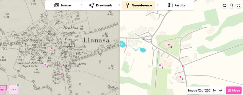
I used AllMaps to georeference, as this technology is easily accessible, and it is the platform that housed the maps I utilized. Looking back at my process, I should’ve been more methodical with how I chose map sheets, but I began georeferencing them in somewhat of a random order. This made it so that once I added each map as a layer in ArcGIS, they were patchy and not adjacent. When I finally added two sheets that were adjacent to each other (pictured below), it was a very exciting moment that made the project feel full. As I continued to add, having the other tiles on ArcGIS made it even easier to georeference the other sheets.
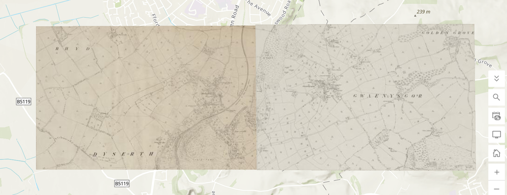
In terms of presentation, I initially georeferenced another map from the library collection that was even older, and displayed all of Wales. However, this muddled the presentation and added unnecessary information. Additionally, because that map was so much older, the coastline was almost completely different from what it is currently. While this is an important piece of geographical data, it wasn’t my main goal, and it made the map harder to read. Now, it’s easier to interact with and understand the map on the basis of the different map sheets.
This project contextualizes older physical maps in a digital format and adds information from the same time period that was created to fit together. Since it has been digitized in the National Library of Wales’ collection, the sheets have been separated, but using this digital humanities technology, we can fit them back together in a helpful and interactive manner. This is something I find to be at the very core of digital humanities: accessibility, interactivity, and opportunities otherwise not afforded by traditional humanities.